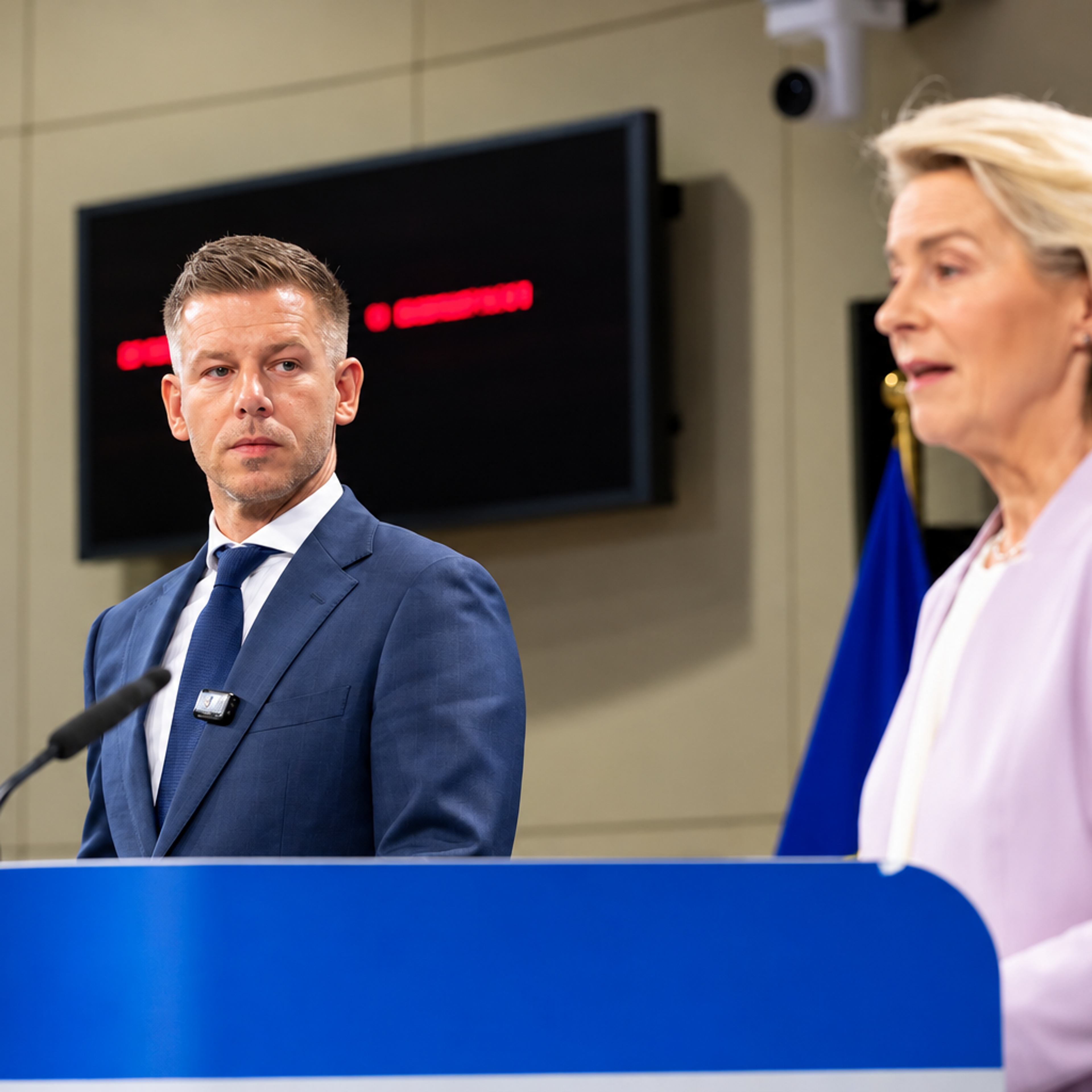
For centuries, cartography has doubled as an instrument of power – colonial-era maps did not merely record territory, they shaped how the world was meant to see itself. On September 4 2026, the UN General Assembly took a symbolic but consequential step towards undoing one such legacy, adopting a resolution encouraging equal-area maps, the product of a years-long campaign led by African organisations and championed diplomatically by Togo. Tied by its advocates to wider debates over decolonisation, reparations and equitable global representation, the resolution passed 164 votes to one.
Titled Correct the Map: Rebalancing Global Cartographic Representation and Promoting Equitable Representation of the World’s Regions, Particularly Africa, it targets the Mercator projection – the 450-year-old map most people grew up with, which shrinks Africa relative to its true size. The United States cast the sole vote against; Estonia, Georgia, Lithuania, Moldova, Serbia and Ukraine abstained.
A map with a history
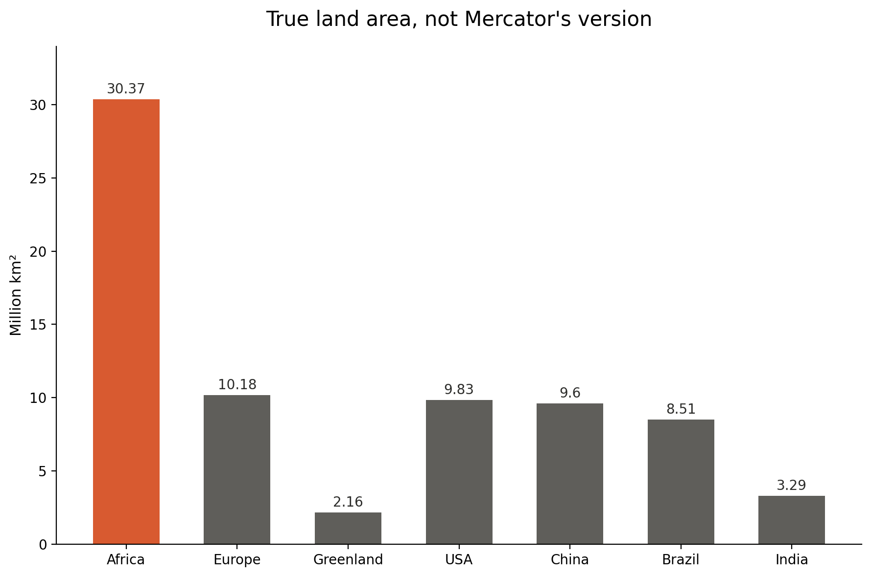
The familiar world map was drawn by Flemish cartographer Gerardus Mercator in 1569 to help sailors plot straight compass courses across the Earth’s curved surface. It served that purpose well, but preserving straight lines meant stretching the map’s longitude – a distortion that worsens towards the poles. Canada, Russia, Greenland and much of Europe loom larger than they really are, while Africa, South America and Southeast Asia shrink; the US, China, India, Japan, Mexico and part of Europe could all fit inside Africa, with room to spare. Geographers have long cautioned against using Mercator for general purposes. Mark Monmonier, professor emeritus of geography at Syracuse University, has noted it was never designed for that role.
Yet Mercator endured, in classrooms, newsrooms and the mental image people carry of the world. Critics, particularly in Africa, believed that mattered. “It might seem to be just a map, but in reality, it is not,” African Union deputy chairperson Selma Malika Haddadi told Reuters, arguing that repeated exposure to a diminished Africa reinforces an impression of marginality – despite the continent being the world's second-largest, home to more than a billion people.
Where the fight began
Mercator’s dominance was challenged long before this campaign. In 1973, German historian Arno Peters introduced the Gall-Peters projection to correct the size distortion; it won some support in education but drew criticism for badly warping continents’ shapes. The debate resurfaced in March 2017, when Boston Public Schools switched its classroom maps to Gall-Peters – raising a harder question: could a map show correct relative sizes without distorting shapes?
Three cartographers set out to answer it: Bojan Šavrič of Esri, Tom Patterson, then of the US National Park Service, and Bernhard “Bernie” Jenny of Australia’s Monash University.
Designing a fairer map
The trio were not starting from nothing. In 2014, they had designed the Patterson projection to reduce polar distortion while keeping continents recognisable; this time they wanted a genuinely equal-area map, where every landmass kept its correct relative size without odd-looking shapes. They used the Robinson projection – long favoured by National Geographic for its visually balanced, if not strictly equal-area, look – as an aesthetic reference, borrowing further from Wagner IV for polar shaping and Eckert IV for softer curves, then widening the map to stop continents looking too tall and narrow. The result, Equal Earth, kept a familiar overall appearance while accurately representing relative size.
Šavrič, Patterson and Jenny published their findings in the International Journal of Geographical Information Science in August 2018. The projection quickly found favour among scientists: NASA’s Goddard Institute for Space Studies used it that same month for a global temperature-anomaly map, and Esri later built it into its ArcGIS software. For years, though, Equal Earth remained largely a specialist tool — until Africa took up the cause.
Africa picks up the campaign
In April 2025, advocacy organisations Africa No Filter and Speak Up Africa launched the #CorrectTheMap campaign, urging schools, media and governments to adopt Equal Earth and framing Mercator’s distortion as part of a broader colonial-era legacy. Africa No Filter’s executive director, Moky Makura, called Mercator’s treatment of the continent “the world’s longest misinformation and disinformation campaign”, while Speak Up Africa co-founder Fara Ndiaye focused on children, warning that generations raised on a visually diminished Africa may absorb a distorted sense of its place in the world. The African Union endorsed the campaign that August and asked a member state to take the issue to the UN.
Togo takes it to New York
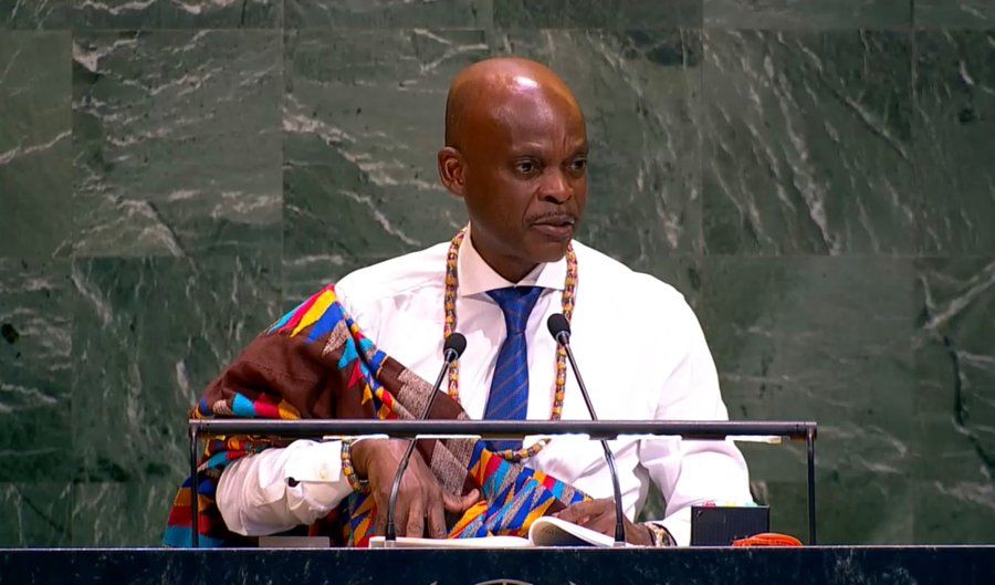
That state was Togo. Foreign Minister Robert Dussey became the face of the diplomatic push, meeting UN member states and hosting a reception in New York ahead of the vote. “A fair world begins with a fair map,” he said, framing the campaign as scientific rather than ideological: “Maps shape our understanding of the world. They guide education, nourish the imagination, and influence collective perceptions.” Togo has pledged to be the first country to rewrite its school geography textbooks using the new approach, targeting completion by the end of 2026.
The resolution was co-sponsored by African Union member states and the Bahamas. France backed it too, with Foreign Minister Jean-Noël Barrot announcing hours before the vote that Paris would abandon Mercator in its own official materials – a striking move given the campaign’s focus on colonial-era cartographic conventions. “Distortions eventually become embedded in perceptions,” he said, adding that “the time has come to correct them."
One objection
The United States was the sole vote against. Washington’s deputy representative to the UN Economic and Social Council, Yaryna Ferencevych, dismissed the resolution as advancing an “ideological agenda” that distracted from more pressing concerns of international peace, prosperity and relations between states, dubbing such measures “barnacles” on the UN’s work.
The resolution does not, however, ban Mercator: its text recognises the projection remains suitable for maritime and aerial navigation, its original purpose. It instead encourages governments, schools, international organisations and technology firms to use equal-area alternatives such as Equal Earth wherever accurate representation of landmass matters.
Reactions
Carlos Lopes, a University of Cape Town professor and prominent advocate, wrote on X after the vote: “164 votes in favour! This is an emotional day for me.” Tom Patterson, writing on behalf of himself and Šavrič, expressed disbelief that the projection they had built as an academic exercise in 2018 had become the basis of a UN resolution: “When we created the Equal Earth projection in 2018, we never imagined this.” Makura insisted the vote was only the beginning: “Now the real work begins. We want to see accurate maps in schools, textbooks, newsrooms, businesses and on the digital platforms billions of people use every day.” The African Union called the vote a turning point that would “ensure the world map finally reflects Africa's true scale, weight, and place in the world.”
What next?
The resolution carries no legal force, and Mercator maps will keep appearing in browsers, classrooms and atlases. But the campaign could push more countries and institutions towards Equal Earth and other equal-area projctions. Togo plans to convene a meeting in Lomé in early 2027 with UNESCO, the African Union and technology companies, including Google Maps, to discuss wider adoption.
Google has already moved away from Mercator in its desktop 3D globe view, introduced in 2018, though its mobile app still defaults to Mercator and desktop users can switch back to it. Whether Equal Earth eventually reaches classrooms and phones will depend on decisions by education ministries, publishers and technology firms – decisions the UN resolution can encourage, but not compel.