Why did the United States stand alone against a map that its own scientists helped build? A week after the United Nations General Assembly voted to adopt the Equal Earth projection, that question still hangs over Washington. On 4 September, 164 countries backed the resolution and six abstained; the US cast the sole vote against – even though NASA and the mapping giant Esri have used the projection for years, and an American cartographer helped create it in the first place.
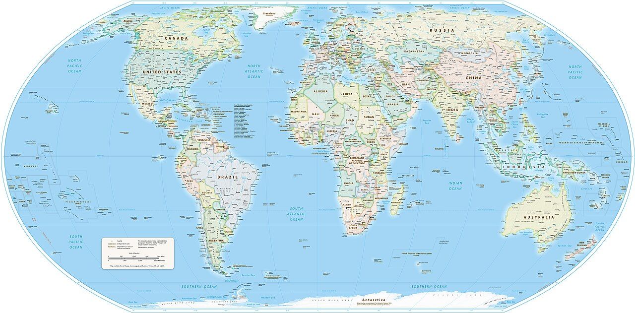
The resolution promotes Equal Earth, which shows the continents at their true relative sizes, in place of the standard produced by Flemish cartographer Gerardus Mercator in 1569 to help sailors plot straight compass courses across a curved Earth. That worked well for navigation, but it meant stretching longitude, a distortion that worsens towards the poles: Canada, Russia, Greenland and much of Europe loom larger than they really are, while Africa, South America and Southeast Asia shrink. The US, China, India, Japan, Mexico and part of Europe could all fit inside Africa with room to spare. Geographers have long cautioned against using Mercator for general purposes.
Tom Patterson, a cartographer with the US National Park Service, was troubled by the problem and went looking for a fix. His interest sharpened in 2017, when Boston Public Schools switched classroom world maps to the Gall-Peters projection – which preserved landmass sizes but stretched shapes so badly that many cartographers found it hard to look at. Unable to find a projection that solved both problems, Patterson approached Bojan Šavrič of Esri and Bernhard Jenny of Monash University in Australia. Together they devised Equal Earth: a projection that keeps continents' relative sizes accurate while giving them shapes that still look recognisably like the Earth on a globe. They published it on August 7, 2018, and it found immediate takers in the US. NASA’s Goddard Institute for Space Studies adopted Equal Earth for global temperature maps, and Esri built it into its ArcGIS software, putting it in front of professional cartographers worldwide. Patterson went on to produce free, high-resolution political and physical wall maps using the projection, drawn from public-domain data that included the CIA’s World Political Map for place names and borders.
Equal Earth was no academic curiosity – it became a working tool for scientists, cartographers, educators and mapping software, living a quiet, useful life in climate science and education. That changed in April 2025, when two African advocacy groups turned the technical case for Equal Earth into a public campaign.
Africa speaks up
On April 7, 2025, ‘Africa No Filter’ and ‘Speak Up Africa’ jointly launched the “Correct The Map” campaign from Dakar, aiming first at schools and then at international organisations and media outlets, urging all of them to drop Mercator for Equal Earth. “Correcting the map is not only an African issue,” said Speak Up Africa co-founder Fara Ndiaye, arguing that generations raised on a distorted map absorb a skewed sense of Africa's real weight in the world. Africa No Filter's executive director, Moky Makura, put it more plainly: “The current size of the map of Africa is wrong.”
The campaign built its public case around one striking comparison: on Mercator, Greenland and Africa look roughly the same size, even though Africa’s 30.4 million sq km make it roughly 14 times larger. That gap between perception and reality anchored the campaign’s petitions, presentations and media interviews as it gathered momentum online through the summer, urging the World Bank, the UN’s geospatial body UN-GGIM, schools, newsrooms and tech platforms to adopt Equal Earth wherever relative size matters to the message being conveyed.
AU endorses campaign
The effort gained its biggest institutional backer on August 14, 2025, when the African Union, the continent’s 55-member diplomatic body, endorsed the campaign. AU Commission Deputy Chairperson Selma Malika Haddadi told Reuters: “It might seem to be just a map, but in reality, it is not,” viewing the misrepresentation as something that colours perceptions of the continent across media, education and policy. The AU tied its endorsement to a wider push around reclaiming Africa’s place on the global stage, linking it to conversations about reparations for colonialism and slavery, and committed to lobbying member states and international bodies for broader adoption.
Togo takes it to the UN
With AU backing secured, the campaign moved from advocacy to diplomacy. Togo led negotiations at the UN on behalf of the African Group, introducing a draft resolution – formally numbered A/80/L.104 and titled “Correct the Map” – during the General Assembly’s 80th session. Foreign Minister Robert Dussey presented the text on September 4. “Maps shape our understanding of the world,” he told delegates, adding that they guide education and shape collective perceptions long after the map itself is forgotten.
Dussey framed the resolution as neither a condemnation of Mercator, whose navigational usefulness he acknowledged, nor an attempt to impose one official map – his point was that a fairer map doesn't change the world’s geography, only how people see it. The resolution doesn’t ban Mercator, create an official UN map, or touch borders or territorial claims; it simply encourages governments, schools, international organisations and technology companies to use Equal Earth and other equal-area projections where relative size matters.
US objection
So why the “no”? Yaryna Ferencevych, deputy US representative to the UN Economic and Social Council, argued that the General Assembly should focus on international peace and prosperity rather than a “16th century” map dispute tangled up with reparations, calling resolutions like it “barnacles on our work here and the reason this institution is losing its credibility”. The abstaining six – Estonia, Georgia, Lithuania, Moldova, Serbia and Ukraine – cited separate, unrelated concerns about how the Equal Earth campaign’s website depicts occupied Crimea.
The irony didn’t go unnoticed: American scientists and a US government agency had done the most, over the previous eight years, to make Equal Earth a working standard. NASA’s climate maps, Esri’s mapping software and Patterson’s free school wall maps had all normalised the projection long before Togo brought it to the General Assembly floor.
For now, Mercator remains the default on most phones and in most classrooms – Google Maps, for instance, still opens a Mercator-style view on mobile even after switching to a 3D globe on desktop in 2018. But with the UN’s formal backing behind it, “Correct The Map” now has something it lacked before: an international mandate to keep pushing.